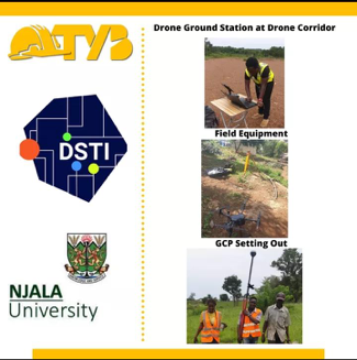
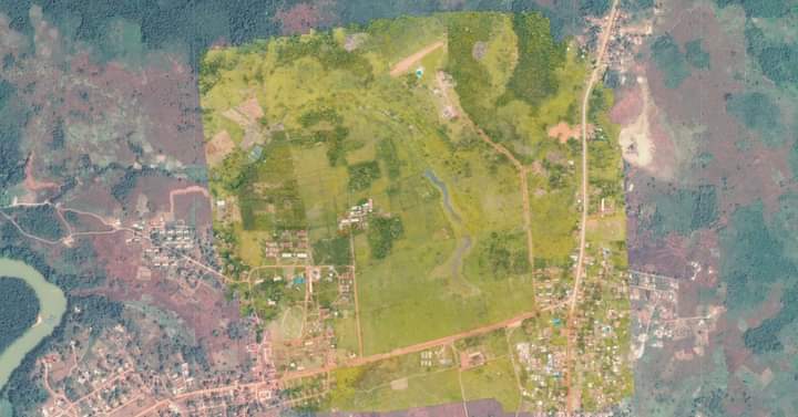
Track Your Build was contracted to conduct an Aerial Survey for the Directorate of Science, Technology and Innovation on behalf of Njala University. The data captured through a drone was used for Aerial Photogrammetry to produce a Topographical Survey as well as an NDVI Survey of a Researchers Farmsite at the Njala Mokonde Campus, Moyamba District.
Photogrammetry is the science of collecting physical information from photos, often aerial images captured by drones, and combining enough images of the same feature. Surveying and GIS professionals use drone photogrammetry, along with accurate GPS data, to create 3D maps and models for use in construction, waste management, mining, and aggregates workflows.
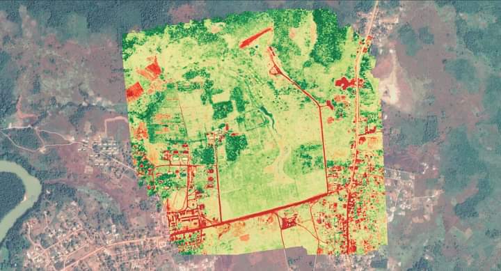
Normalized Difference Vegetation Index (NDVI) is a measure of the state of plant health, based on how the plant reflects light at certain frequencies (some waves are absorbed and others are reflected).
This is part of the ongoing Human Capital Development Incubator work at DSTI. The HCDI was set up at DSTI to design and pilot data-driven solutions, to accelerate impactful investments in Sierra Leone’s human capital. It is focused on driving innovations in the education, health and agriculture sectors using a three step approach.
TYB mapped out a total of 932 acres in 4 hours. During data collection, a total of 7 Ground Control Points were set out and collected. During post-processing, a total of 517 pictures were processed, producing a map with 5cm Ground Sampling Distance. The obtained datasets were then further processed into 2D planimetric and topographic CAD drawings and NDVI analysis of the site.