
“Over the past years analysis and visualization of surveillance data collected by districts has been a major constraint at district level due to lack of knowledge in Geospatial technologies among other challenges” says Mr. Ousman J.D Kamara. He added that since 2019 when he was assigned as a District Surveillance Focal Point in Bombali District, his main duties have been to collect surveillance data for priority animal diseases and pests for transmission by the District Livestock Officer to the Ministry of Agriculture and Food Security (MAFS) headquarters in Sierra Leone without performing any analysis.
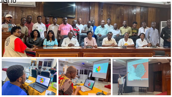
To address these numerous challenges faced by Mr Kamara and other District Animal Health personnel, the Food and Agriculture Organization of the United Nations (FAO), with funding from the United States Agency for International Development (USAID) under the Global Health Security Program (GHSP) organized a training for District Livestock Officers and Surveillance Focal Persons in selected districts in Data Visualization, Disease and Risk factor Mapping using Geographic Information System.
Sierra Leone’s capacity on Disease and Risk factor mapping using Geographic Information System (GIS)
Risk mapping, spatial analysis for value chain studies and data visualization of animal disease outbreaks and related risk factors have become increasingly important in a surveillance system since they allow veterinary and public health services to understand and explain the dynamics and patterns of disease emergence or spread and increase the speed of response in case of disease emergency. Despite these known benefits of GIS in the control and prevention of animal diseases, Sierra Leone’s Veterinary services had no personnel at district level with necessary training or capacity to perform this activity.

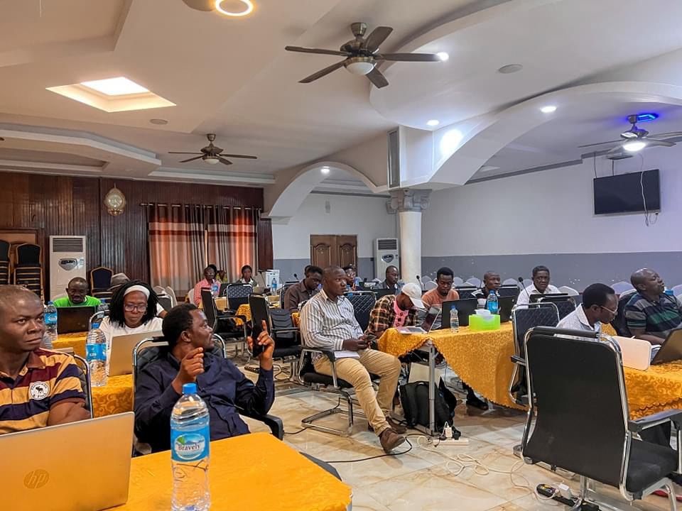
To address this gap, FAO organized a five-day training in GIS from 6th -10th August 2024 for key staff from the Livestock and Veterinary Services (District Livestock Officers, District Surveillance Focal Points, Central Veterinary Laboratory, Epidemiology Unit and Directors of Livestock and Veterinary services) as well as Sierra Leone Agricultural Research Institute and Wildlife personnel from Ministry of Environment and Climate Change. The training was delivered by personnel from the Livestock and Veterinary Services Division in the Ministry of Agriculture and Food Security.
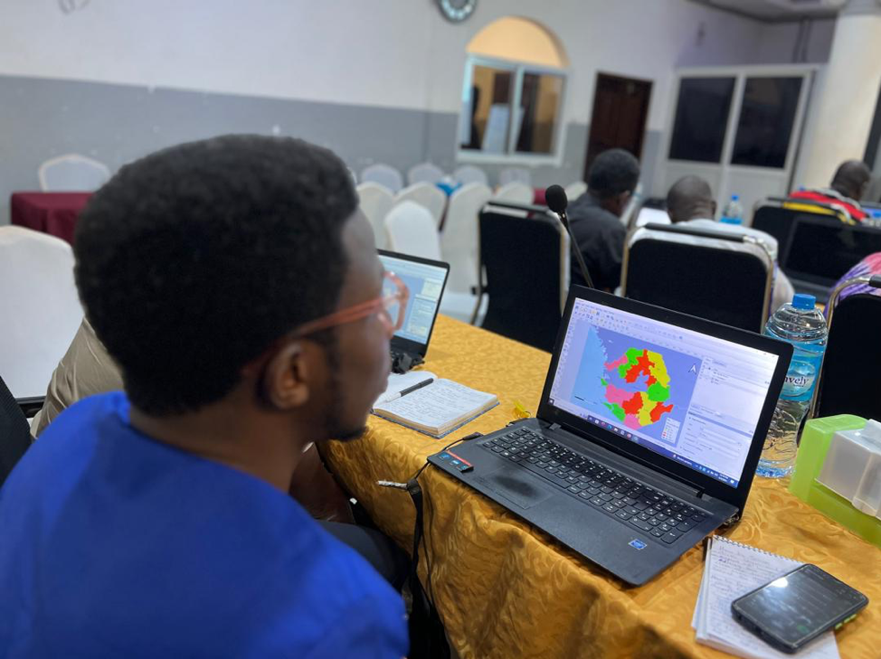
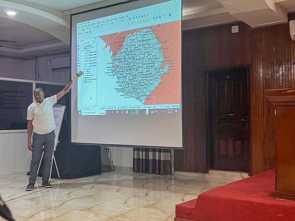
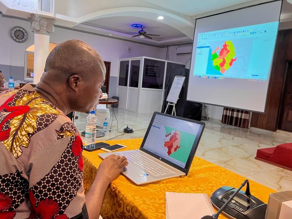
The training was largely hands- on with numerous practical sessions and exercises where the trainees used Sierra Leone datasets to perform basic mapping, spatial analysis and data visualization of vaccination coverages, animal disease outbreaks, and related risk factors. To extend the learning beyond the classroom, the trainees were provided with learning materials including step by step manuals, sample datasets and reference materials.
The Director of Livestock and Veterinary Services, Saidu Bamayange who officiated at the opening ceremony commended the training and its relevance to the country’s livestock sector and capacity building efforts to prevent, detect and respond to priority zoonotic diseases and other high impact diseases. He appreciated FAO ECTAD for the extraordinary work it is doing to elevate the Livestock sub-sector and the USAID for funding. “Geographical Information System knowledge has been stuck for a long time within the epidemiology unit at the Ministry. The districts also need this knowledge to add value to the work they are doing” Bamayange said. He said that the Epidemiology Unit in the Livestock and Veterinary Services Division is mandated to analyze all the data transmitted from the districts, interpret, prepare animal health reports that are presented during weekly Emergency Preparedness Resilient Response Group (EPRRG) meetings. The EPRG meetings are attended by officials from the One Health Ministries, Departments and Agencies as well as Partners. This training is intended to build the capacity of the districts staff to undertake analysis and visualization of animal health data collected from the livestock farmers and presented during EPRRG meetings. He thanked FAO for the initiative to cascade the GIS knowledge downwards to the sub-national level.
Previous efforts by Government of Sierra Leone and partners
FAO ECTAD in Sierra Leone over the years from 2016 to date, has been supporting the Livestock and Veterinary Services in the Ministry of Agriculture and Food Security as well as the Wildlife Unit in the Ministry of Environment and Climate Change to strengthen surveillance for priority transboundary animal diseases and zoonoses. In this regard, FAO supported MAFS and MoECC to establish Integrated Animal Disease Surveillance Systems (IADSR), epidemiology units and Event Mobile Application (EMA-i). Through the IADSR and EMA-i animal health personnel at district level regularly collect raw data from the livestock farmers and electronically transmit it to the Epidemiology Unit at MAFS headquarters for analysis, interpretation and production of Weekly Epidemiological Animal Health bulletins. The Bulletins are widely shared with various stakeholders including partners through various google groups.
Given the importance of disease outbreak and risk mapping,
To further strengthen surveillance systems in Sierra Leone, FAO regional and Global level conducted a training in Freetown in GIS using the Quantum GIS (QGIS) open-source software in which 25 personnel from the veterinary and wildlife services as well as public health were trained. This was followed by a series of annual regional GIS trainings organized by FAO regional and Global level in which two (2) officials selected from the Livestock and Veterinary services participated. These trainings enabled the Livestock and veterinary services personnel to acquire skills to analyze surveillance data and present the sanitary information on disease prevalence, disease outbreaks, vaccination coverages in form of maps for better prevention, detection and control of transboundary animal diseases including PZDs in the country.
With this skill, the two people from the Livestock Veterinary Services that benefited from the regional GIS trainings cascaded the trainings to personnel at national, district and community level that are engaged in animal and wildlife surveillance.
It is anticipated that the personnel trained will share the skills gained with the rest of the technical staff within their districts and institutions by applying the skills gained in their day-to-day work and therefore facilitate wider use of Geospatial technology within the sectors. Use of Geospatial technology will help the Ministry of Agriculture and Food Security as well as Ministry of Environment and Climate Change to better fulfill their mandates by displaying geospatial data on different disease outbreaks for policy makers and planners to make informed decisions.
Contact :
Communications Consultant
FAO Sierra Leone
&
Dr René Bessin
Country Team Lead CTL-ECTAD
FAO Sierra Leone